 |
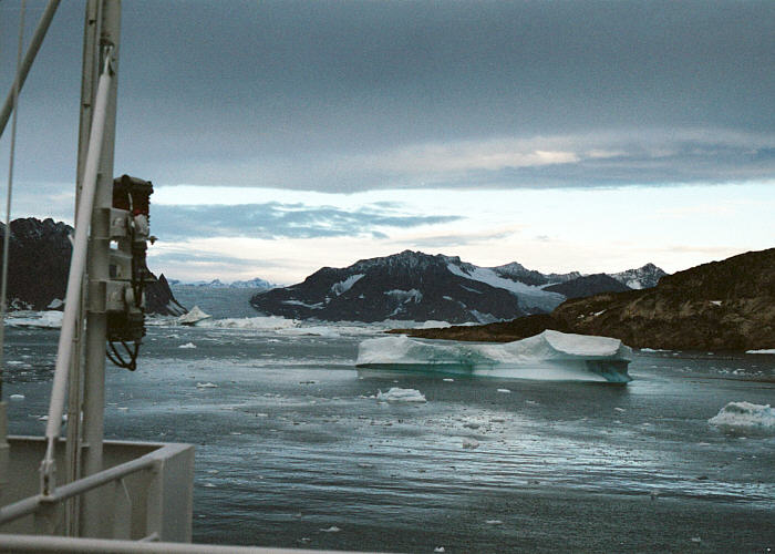
Morning, looking south toward the mouth of the Kangerdlugssuaq
Fjord. The weather change overnight has shifted the ice around, some back into our
sheltered fjord where we spent the night. |
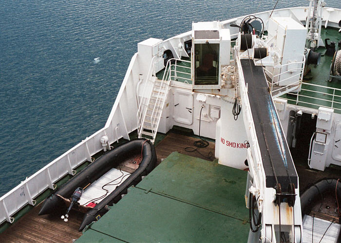 |
Looking down from above the bridge to the middeck, looking
at the cover to the hold and two of the three Zodiacs. |
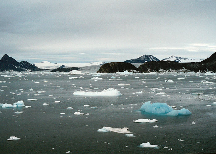 |
Traveling to the drop off point outside Uttental Sund. Lots
of small bergs and ice bits around. |
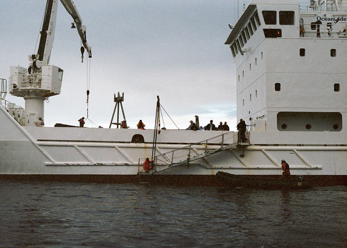 |
The lowered gangplank, with a Zodiac moving into position to
take on passengers. |
 |
View of the stern of the ship, with the second Zodiac
loading up and the third still empty. |
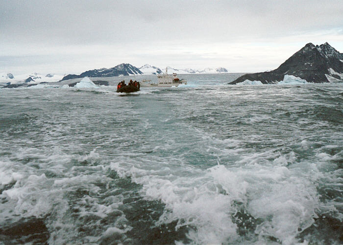 |
Traveling into Uttental Sund, leaving the ship behind in
open water. |
 |
Photo from the Zodiac, looking northeast. Right peak is Pukugagryggen, left is Wagers Peak. Pukugagryggen has the Triple Group
exposed about 2/3 of the way up the cliff, and below the Triple Group is a large
gabbroic anorthosite autolith. A giant autolith is also barely discernable below
Wagers Peak. |
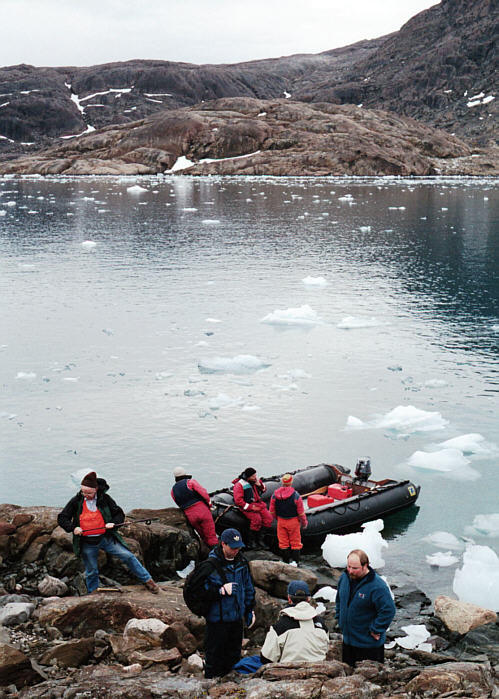 |
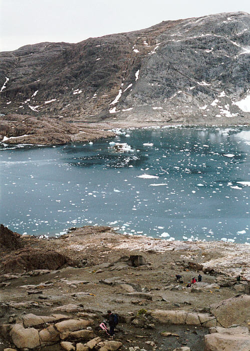
Disembarking from the Zodiacs just west of the contact
between Archean gneisses and the Skaergaard, just south of Uttental
Plateau. View is to the south across Uttental Sund. |
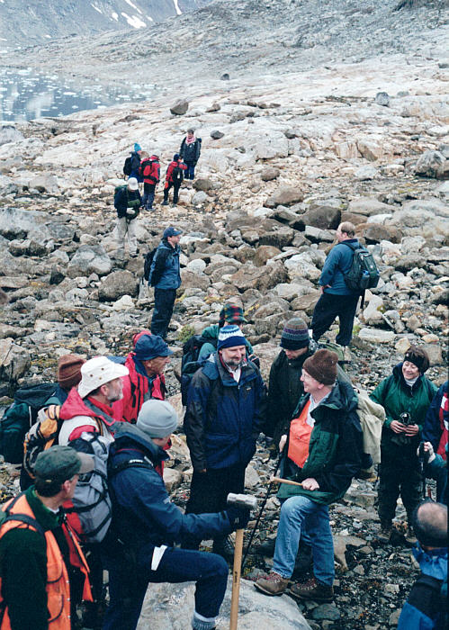 |
discussion near the Skaergaard contact, which is approximately at the position of the distant people. |
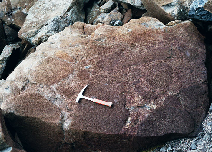 |
Photo of the Marginal Boarder Series near the contact,
showing ultramafic xenoliths (cumulate wherlite with interstitial
plagioclase) included within the marginal border group gabbro. The olivine
in the xenoliths is Fo80 to 85, which is too Mg-rich for Skaergaard if the
hidden zone is small, as gravity models indicate. It seems likely that this wherlite is from ultramafic cumulates in a somewhat older Tertiary pluton
cut by the Skaergaard. Such bodies are found in the area. |
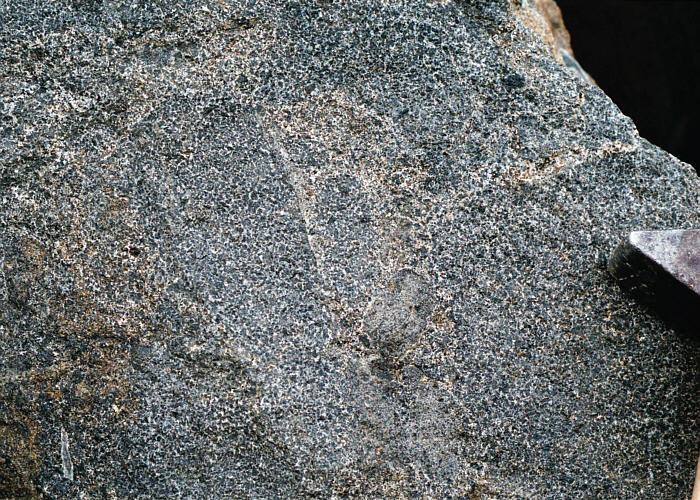 |
Closer view of a fresh surface, showing densely packed wherlite xenoliths, larger grains visible are
olivine. |
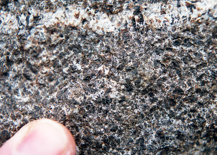 |
Closeup of one of the wherlite xenoliths, the larger
crystals being pyroxene, with smaller olivine crystals and interstitial
plagioclase. The olivine appears dark because they contain cracks where the
olivine has been partially converted to serpentine and magnetite. |
 |
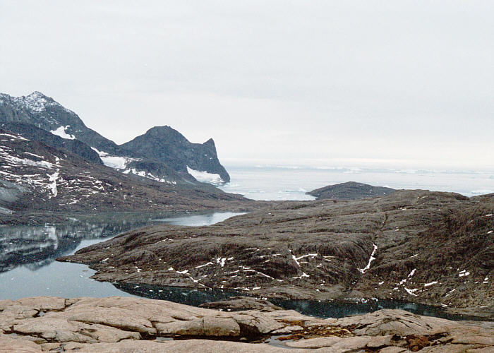
Looking south across Uttental Sund, down the contact on this side of the
water and up the contact on Kramer Island on the other
side. Ice in the water is mostly sea ice. This photo was taken from an elevation
of ~150 m in the "Tranquil Zone", in a section with relatively featureless gabbro having 2
to 3 cm augite oikocrysts enclosing olivine and plagioclase cumulus minerals. |
 |
Cross bedded gabbro in the cross bedded belt of LZa. |
 |
View to the south across Uttental Sund to Skaergaard Bay
and the open Greenland Strait. Foreground is the LZa gabbros on Uttental
Plateau, Kramer Island is in the midground, and the
Homestead area is in the
middle distance. Highest full peak near Skaergaard Bay (center) is Pilespidsen, 768
m. |
 |
Looking NE from the summit of Uttental Plateau toward
Watkins Fjord. Much of the ice in this and in Kangerlussuaq Fjord comes from
glaciers in Watkins Fjord, one of which can be seen opposite on the right
center. |
 |
Crossbeds in the crossbedded belt on Uttental Plateau, in
LZa. View is looking east toward Wagers Peak. |
 |
Channel fill and crossbeds in the crossbedded belt on
Uttental Plateau, in LZa. Notice the small white autoliths near the base of
the scoured surface. |
 |
Perpendicular feldspars growing inward from the base of the
scoured surface in the photo above. |
 |
Replacement gabbroic anorthosite body, showing a thin mafic layer at
its base. This body has abundant mafic oikocrysts, which is typical of this
kind of rock. Stratigraphic tops are toward the top of this photo. |
 |
Small mafic pegmatite in LZa, stratigraphic tops are toward the
top of the photo. |
 |
Small mafic pegmatite in LZa, connected to a replacement
gabbroic anorthosite at its top. The mafic pegmatites and replacement anorthosites
appear to be related in many places, probably related to the availability of
water and its control on the residual liquid phase relations. |
 |
A large replacement gabbroic anorthosite body, just northeast of the summit
region of Uttental Plateau. |
 |
Graded layers and crossbeds near the margin of the crossbedded belt, LZa, with several bodies of replacement anorthositic
gabbro above
a large dark brown-weathering trough structure. |
 |
View to the north from the north rim of Uttental Plateau
toward one of the glaciers at the end of Watkins Fjord. The blue ice calving
front of one glacier visible in the distance has ice streams extending back into
the distant Greenland interior. The icecap is not visible from here. |
 |
Another small replacement anorthositic gabbro, this one sub-parallel to
some layering, and has a mafic layer on the bottom. Notice the truncated
layers just to the left of the anorthositic gabbro. |
 |
Closeup view of the replacement anorthosite in the photo above,
showing abundant oikocrystic pyroxene. |
 |
Photo of the gabbroic anorthosite diapir, west side of
Wagers Peak in LZb. This is a complex structure that is not fully
understood. It has a flat base and a mushrooming top, with upturned beds on
the right and less steeply upturned beds on the left. Just to the right of the top
of the structure the beds are disturbed (see photo below). One idea is that
this is a a real diapir, that pushed aside and broke the overlying layers. The
resulting bump then caused turbulence in the magma that deposited in the
disturbed bed. Unless the rising magma or mush body was fed from deeper down to
give the anorthositic material sufficient hydrostatic head to raise the 2 or 3 m
of semiconsolidated crystal mush, it is difficult to see how diapirism would
succeed. Another idea is that this body
was precipitated in situ from water-bearing, plagioclase-rich liquids fed from below.
In this scheme the structure grew into a mushroom as left the floor
cumulates and entered the magma chamber above. The migrating
plagioclase-rich liquid would loose water to the adjacent water-poor magma
and freeze. More liquid from below would construct a growing mushroom. In this model the
upturned beds therefore are primary features like the upturned beds on the
flanks of autoliths. |
 |
Photo from slightly to the south of the mushroom, showing
another body of gabbroic anorthosite slightly lower in the section, and the striking disturbed bed to the
right of the mushroom top. |
 |
Photo of the rock that makes up the body of replacement
anorthosite to the right of the mushroom, seen in the photo immediately
above. |
 |
Photo of the rock in LZb, 20 m south of the mushroom. |
 |
Photograph looking southeast from the mushroom locality on the west
flank of Wagers Peak. Uttental Sund is the water far below. The nearby body
of water is a small lake at 141 m elevation on the southern flank of Uttental Plateau. The
Skaergaard-Archean gneiss contact is beautifully exposed on the other side of Uttental
Sund on Kramer Island. |
 |
Photo of the Uttental Plateau from near the gabbroic anorthosite
mushroom locality, shown above. Note people, on the top of the plateau at
the far right. Most of this view shows LZa which, inside of the crossbedded belt, is rather featureless with
little in the way of layering. In contrast, LZb does have layering. |
 |
Photo looking uphill near the pickup place on Uttental Sund, showing layers in LZb. Note the presence of both regular and irregular
layering, and truncations. |
 |
View from the Zodiac toward Basistoppen (885 m), looking up
Forbindelses Glacier. |
 |
Blue iceberg just outside of Skaergaard Bay. |
 |
Another blue iceberg just outside of Skaergaard Bay. |